REVIEW · PRAIA
Santiago: Monte Tchota Natural Park to Pico d’Antónia Hike
Book on GetYourGuide →Operated by Bu Country Tours · Bookable on GetYourGuide
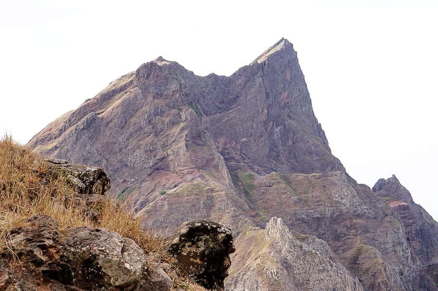
Pico d’Antónia is the kind of climb that pays you back fast. This trek from Monte Tchota Natural Park goes up to Santiago’s highest point (1394 m), and on clear weather you can spot far-off islands like Maio and even the Volcano of Fogo. I like how the route is built around real terrain—cooler highland footpaths, a micro-climate, and long sightlines—so the scenery feels earned. One thing to keep in mind: this is a difficult hike on a narrow, tilted trail, so it’s not a casual stroll.
Two things I especially like: first, the biodiversity and micro-climate around Monte Tchota. At about 800 meters, the air tends to feel cooler than in lower Santiago areas, and the vegetation gives you a different mood for the day. Second, the view payoff from the top is practical, not just pretty—São Jorge Valley first, then wider horizons, including Maio and Fogo if the weather behaves.
The possible drawback is simple: the elevation change is big for a one-day effort. Expect about 660 m of climbing, about 9 km total walking (with an estimated 4–5 hours on foot), and some uneven footing that can include level 1 scrambling. If your fitness is moderate or your knees hate slopes, you’ll want to go prepared.
In This Review
- Quick take: what makes this hike worth it
- Monte Tchota: the cooler start at 800 meters
- Climbing to Pico d’Antónia (1394 m): the view you came for
- Trail reality check: one-way, narrow, and slightly tricky
- Picnic break: your energy plan for the harder sections
- Summit panorama: São Jorge Valley, Maio, and Fogo when it’s clear
- Guides, group size, and pacing that actually works
- Price and value: $100 for a full-day climb with real support
- Who should book this hike, and who should skip it
- Should you book the Monte Tchota to Pico d’Antónia hike?
- FAQ
- How long is the hike from Monte Tchota to Pico d’Antónia?
- What is the trail distance?
- How difficult is it?
- What’s the elevation gain and highest point?
- Is the trail a round-trip route?
- What’s included in the price?
- Where does pickup happen?
- What should I bring?
- What languages are available for the guide?
- Who is this not suitable for?
Quick take: what makes this hike worth it
- Monte Tchota’s cooler start at around 800 m, with a distinct micro-climate feel
- Pico d’Antónia (1394 m) for wide, high-level views over Santiago
- Big horizon visibility: Maio and Fogo can appear if visibility is good
- Difficult, narrow trail with tilted sections—proper shoes matter
- Guides who manage pacing and safety, like Elder, who can explain nature in an easy way
- Picnic stop for a real break before the hardest parts
Monte Tchota: the cooler start at 800 meters
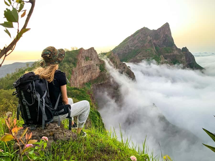
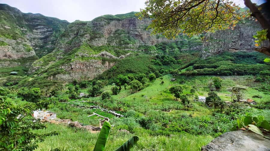
Your day begins with a drive to Rui Vaz, then you start climbing into Monte Tchota Natural Park. This is one of the reasons I like this hike so much: the park doesn’t just look scenic on a map, it changes the feel of the air. Monte Tchota sits around 800 m, and that altitude shift can make the whole morning feel cooler than you’d expect on Santiago. That matters. When you’re climbing, cooler temperatures help you move longer without burning out.
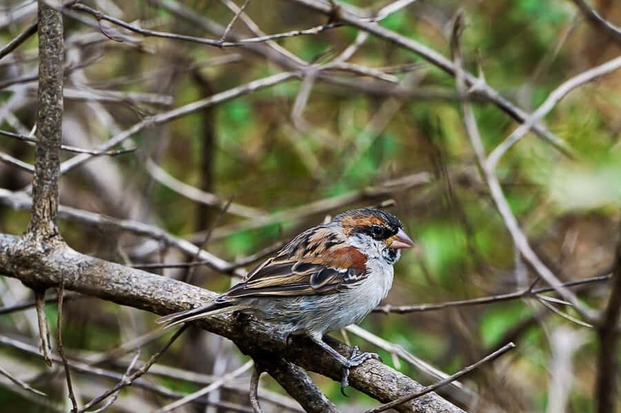
You’re also in a place with its own mix of life—biodiversity is part of the selling point here, and you’ll notice it in how the landscape behaves as the trail rises. The guide is there to turn what could be a quiet walk into something more meaningful. In particular, I’ve seen feedback praising guides like Elder for being helpful, empathetic, and able to share what’s around you in a way that doesn’t sound like a lecture. That’s the sweet spot for nature walks: enough information to make the view land, not so much you’re stuck thinking about plants instead of steps.
The tradeoff for this “cooler and more alive” start is that you’ll likely feel the climb ramp up steadily. There’s no quick shortcut past the hard part. You’re going up because the destination is high—and the park sets you up for the upper views later.
You can also read our reviews of more hiking tours in Praia
Climbing to Pico d’Antónia (1394 m): the view you came for
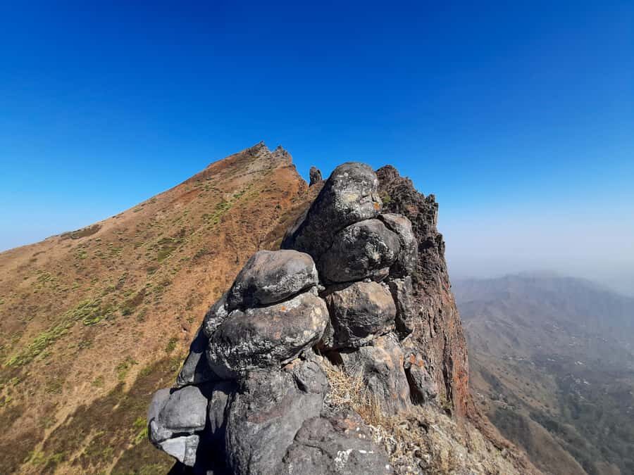
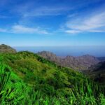
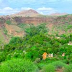
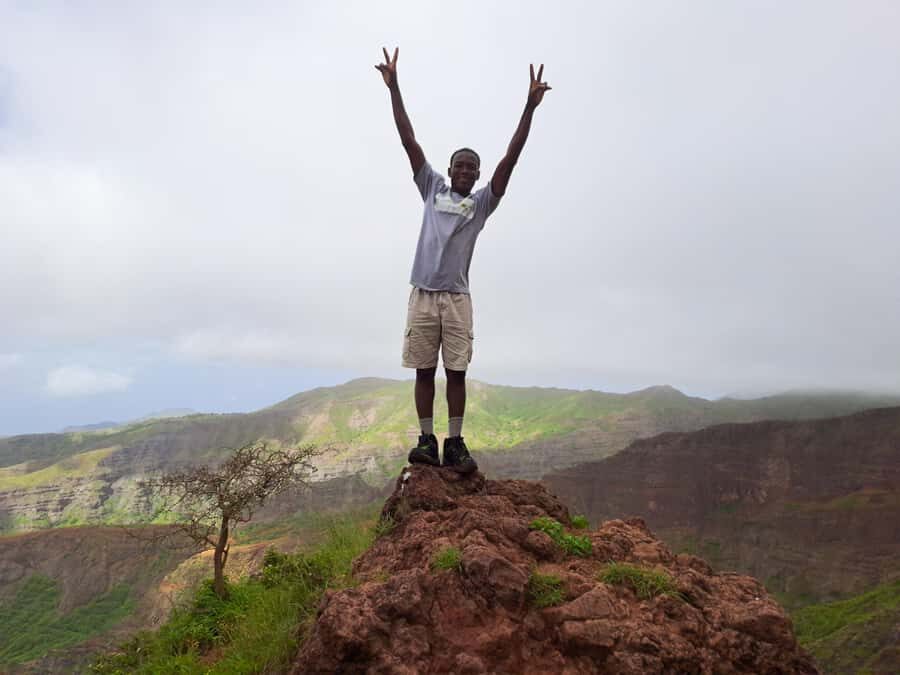
The route continues from Monte Tchota toward Pico d’Antónia, the highest point on Santiago Island at 1394 meters. As you get closer to the top, the pace and the payoff start to shift. Near the summit area, the views open out over the São Jorge Valley—and that’s where the hike stops feeling like a workout and starts feeling like geography in motion.
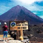
A key detail: you can also get a chance to see Maio Island and the Volcano of Fogo in the distance, but only if weather and visibility cooperate. That uncertainty is normal in island-hopping view physics, so I’d plan for a strong Santiago panorama first, and treat Maio/Fogo as bonus points when conditions are clear.
The elevation numbers tell you why the top is worth it. You’ll climb roughly 660 m, with a max elevation around 1400 m, and the route involves significant ups and downs overall (the data lists elevation loss/gain figures that suggest the trail isn’t a single smooth ascent). Translation: you’ll feel your legs on the way up, and you’ll still need control on the way down or along uneven sections as you reposition for the return leg.
Expect the total trek to take about 5 to 6 hours including a pause. That usually means you’re walking steadily for a good part of the day, not stopping every 10 minutes for photos. You’ll get plenty of chances to look, though—just not the kind of guided tour schedule where you feel rushed every step.
Trail reality check: one-way, narrow, and slightly tricky
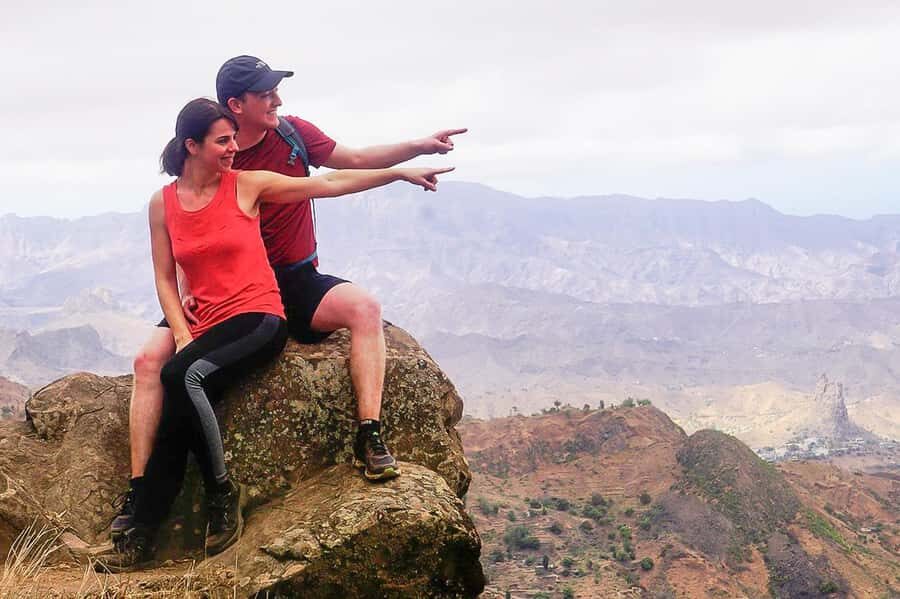
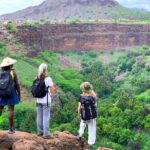
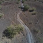
Here’s the part you shouldn’t gloss over: the trail is rated difficult, and the path quality is described as tilty, narrow. In plain language, that means balance matters. You can’t just put your head down and shuffle. You’ll likely be making small course corrections as you walk, especially when the surface is uneven.
This is also a one-way trail type. You’re not doing a simple out-and-back hike where every step mirrors the previous one. The route ends with a return to Monte Tchota Natural Park and then a ride back to your hotel. So even if the walking is one-way overall, you still finish back in the park area.
The good news: you’re not going alone in the tricky parts. A guide is with you for pacing and safety, and the reviews I’ve seen emphasize that the best guides help you keep moving at a human speed. One review notes the guide went mostly in their pace and was well informed and helpful, which is exactly what you want on narrow trails.
What I’d personally prepare for:
- Footwear with grip, not worn-out sneakers
- Hiking pants, especially from August to November (recommended)
- Water and snacks time, so you’re not rationing energy
Also, some trails may require level 1 climbing, so don’t treat this as flat walking. If you use walking sticks, the guidance suggests they can help—especially for stability on slopes and uneven ground.
Picnic break: your energy plan for the harder sections
You’ll take a stop for a small picnic with soft juice, a sandwich, and fruit. I like this because it’s not a long meal that kills momentum. It’s short enough to keep your rhythm, and it’s the kind of food that makes sense during a hike: carbs for energy, simple hydration, and fruit to top you off.
The timing matters in your head. If you arrive at the toughest stretch already hungry, you’ll pay for it on the climb to the top and on the return sections. The picnic helps you reset so the summit isn’t just “the hardest moment,” it’s the moment you’ve planned for.
One more practical note: bring drinks and water. The picnic includes soft juice, but hiking is about managing your own hydration. The guidance specifically calls out bringing water, and with a difficult rating and elevation gain, I’d treat water as non-negotiable.
Summit panorama: São Jorge Valley, Maio, and Fogo when it’s clear
From near the top, panoramic views are the headline. The first big moment is the São Jorge Valley view. Valleys from height usually look layered—distance stacks on distance—so it’s easier to understand where towns and ridgelines sit relative to each other.
Then you look outward for Maio Island and the Volcano of Fogo. You may get them, you may not. That’s not a marketing trick; it’s simply how island visibility works. Haze, cloud cover, and wind can cut off the far distances. But if the day is clear, this is one of the rare chances to see other islands from Santiago without switching islands.
This is where good guiding earns its cost. A guide can help you identify what you’re looking at and explain what makes the terrain behave like it does. The feedback about Elder specifically points to strong knowledge delivered in an easy, accessible way. That kind of explanation turns a far view into something you can actually read.
And yes, the end can feel hard. One review notes the climb to the summit wasn’t easy at the end, but that the landscapes made it worth it. That matches what the difficulty rating suggests: the summit is a reward, not a casual stop.
Guides, group size, and pacing that actually works
This tour runs with a live guide and is available in English, French, Spanish, and Portuguese. It also offers private or small groups, which is a big deal on a narrow trail. Smaller groups mean you’re less likely to get trapped behind slower walkers or rushed by faster ones. You want time to check your footing, breathe, and keep your line.
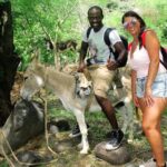
I’ve also seen praise for the way guides manage group energy. One review highlights that Elder was exceptional—helpful, empathetic, and attentive to safety during harder moments. That’s the practical version of “great guiding.” It means you’ll get encouragement when needed and guidance when the path changes.
If you’re the type who gets stressed on uneven ground, a supportive guide can make the hike feel less intimidating. If you’re an experienced hiker, a good guide still helps by keeping the route smooth and reducing wasted time.
One more angle: the driver matters too. Another review calls out an exceptional driver alongside excellent guides. On a day that includes pickup and the ride back after a difficult walk, that transportation smoothness helps you finish the tour feeling like it was handled, not just endured.
Price and value: $100 for a full-day climb with real support
At $100 per person for a roughly 6-hour experience, this is not a budget “quick hike” price. But it also isn’t just you paying for a route and a vague meeting point.
You’re paying for:
- Pickup and drop-off at your accommodation in Praia or São Jorge dos Órgãos
- Transportation to and from the trail area
- A tour guide for safety, pacing, and on-the-ground interpretation
- Liability insurance
- A picnic (soft juice, sandwich, fruit)
From a value standpoint, the guide and transportation are the main costs you’re avoiding on your own. Hiring a guide and arranging transport in a place like Santiago can eat time fast, and time is the real expense on a hike day. With the structure already handled, you can focus on shoes, water, and pacing—exactly what you should be thinking about.
One caution on value: if you’re not in Praia, the data says you’ll need to pay an extra fee for pickup and drop-off. If you’re staying outside those areas, ask ahead so you can compare the true final cost to what you expected.
Who should book this hike, and who should skip it
This hike fits best if you:
- Can handle a difficult rating and uneven footing
- Walk confidently for 4–5 hours plus stops
- Are comfortable with elevation gain and a narrow trail environment
- Want a summit view that includes other islands when the weather allows
It’s also for people over 16 years old, so it’s not the kind of adventure you’d do with younger kids.
Skip it if:
- You’re pregnant
- You have mobility impairments, use a wheelchair, or need accessibility accommodations
- You have respiratory issues
Those limitations matter because the route involves difficulty, narrow tilty paths, and possible level 1 climbing.
Should you book the Monte Tchota to Pico d’Antónia hike?
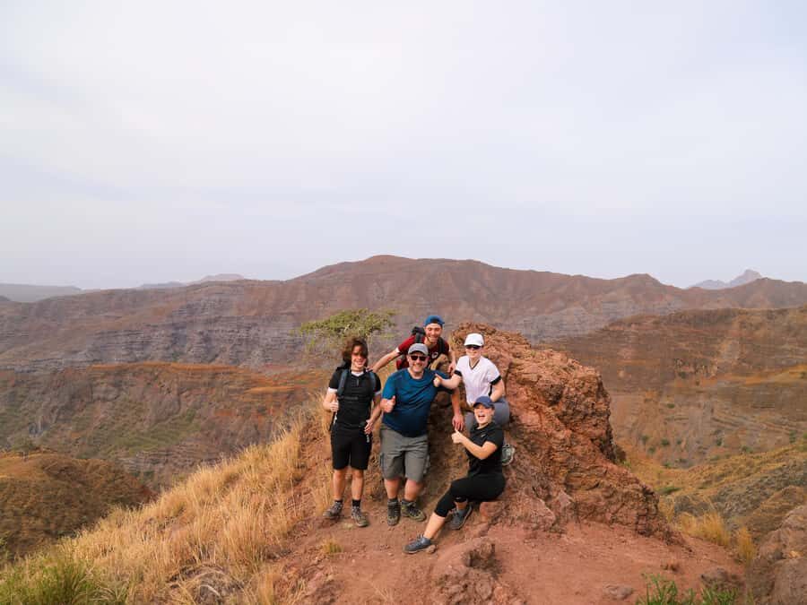
I’d book this if you want a high-effort day that ends in a wide, elevated reward—and you’re okay with the trail being narrow and challenging. The best reason to go is the combination: Monte Tchota’s cooler micro-climate plus the summit position at 1394 m. Add a capable guide (with real safety attention, like Elder) and a simple picnic, and it becomes a solid value package rather than a stressful scramble.
I’d think twice if you’re easily intimidated by uneven trails, even if you’re generally fit. This isn’t only about endurance. It’s also about balance and sure steps. Bring hiking pants, strong shoes, and water, and you’ll give yourself the best shot at enjoying the views instead of wrestling the ground.
If you love seeing Santiago from above—and you hope for Maio and Fogo when the sky is clear—this is a great way to spend a day.
FAQ
How long is the hike from Monte Tchota to Pico d’Antónia?
The tour runs about 6 hours total. Walking time is roughly 4–5 hours, with a break for a small picnic.
What is the trail distance?
The hike distance is about 9 km (approximate).
How difficult is it?
It’s rated difficult, with steep sections and a narrow, tilty path quality. There may be level 1 climbing on some trails.
What’s the elevation gain and highest point?
Elevation gain is about 660 m. The highest point is around 1400 m, with Pico d’Antónia at 1394 m.
Is the trail a round-trip route?
The trail type is listed as one-way. The route ends back in the Monte Tchota Natural Park area, followed by the ride back to your hotel.
What’s included in the price?
Pickup and drop-off in Praia or São Jorge dos Órgãos, transportation, a tour guide, liability insurance, and a picnic (soft juice, sandwich, fruit).
Where does pickup happen?
Pickup is included from accommodations in Praia or São Jorge dos Órgãos. If you’re not in Praia, an extra fee for pickup and drop-off applies.
What should I bring?
Bring a sun hat, hiking shoes, sunscreen, water, and drinks.
What languages are available for the guide?
The live guide is available in English, French, Spanish, and Portuguese.
Who is this not suitable for?
It’s not suitable for pregnant women, people with mobility impairments, wheelchair users, or people with respiratory issues. It’s also for travelers over 16 years old.