REVIEW · PRAIA
Hiking: Monte Tchota Natural Park – Pico D’Antónia (1394m) – Longueira
Book on Viator →Operated by Bu Country Tours · Bookable on Viator
Monte Tchota has a way of changing your pace. You start in Praia, climb to Pico D’Antónia (1,394m), and finish with a walk through Longueira’s mountain homes and farm fields. It’s a hike that mixes big altitude effort with real Cape Verde daily life—plants, birds, crops, and conversation with locals.
What I like most is the human side of the day: an experienced local guide keeps things safe and moving, and the group is small (max 8 people). I also really appreciate the built-in reward: a picnic lunch up top, plus a weather-dependent chance to spot Fogo Island on the horizon.
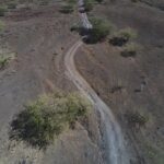
One thing to be honest about: this is a difficult hike. You’ll cover about 9 km with steep ups and a long drop on narrow, tilty paths, and it’s only a good match if you have strong fitness and comfortable footing.
In This Review
- Key things to know before you go
- Monte Tchota Natural Park: why this hike feels genuinely Cape Verde
- Price and timing: what your 6-hour day really includes
- The climb to Pico D’Antónia (1,394m): difficult, but not random
- Endemic plants, birds, and seasonal crops on the way up
- The picnic lunch at the top: why that stop changes the whole day
- Descending through farmland and Longueira’s carved mountain homes
- Views toward Fogo Island: enjoy them, don’t bet on them
- Guide, driver, and group size: safer hiking without feeling rushed
- What to pack: the difference between a good day and a miserable one
- Who should book this Monte Tchota hike, and who should skip it
- Should you book Monte Tchota to Pico D’Antónia?
- FAQ
- What time does the Monte Tchota Natural Park hike start?
- How long does the experience last?
- Where do you get picked up and dropped off?
- Is admission included?
- How far and how hard is the hike?
- Do I need hiking shoes, pants, or walking sticks?
- Is there food included during the hike?
- Can I see Fogo Island during the hike?
- What happens if the tour is canceled due to weather?
- How does cancellation work?
Key things to know before you go
- Small group (max 8) with an experienced local guide for a safer pace
- Picnic lunch at the top of Pico D’Antónia, timed as a real mid-hike reward
- Endemic plants and birds plus seasonal crops (corn, mango, coffee, tomatoes)
- Steep, narrow trails with some simple level 1 climbing and level changes
- Weather matters for panoramic views and any chance of seeing Fogo Island
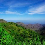
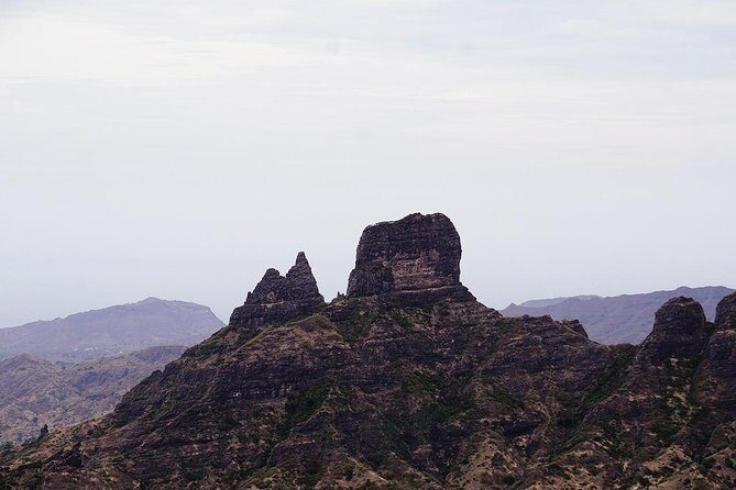
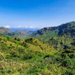
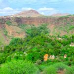
Monte Tchota Natural Park: why this hike feels genuinely Cape Verde
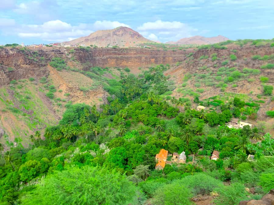
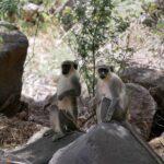
Monte Tchota Natural Park isn’t just a viewpoint mission. You’re walking through a real island system—native plants, local birds, and the patchwork of agriculture that clings to the slopes. That matters because it turns a “climb to a summit” into a lived-in walk across how people actually make the land work.
The Pico D’Antónia part gives you the altitude payoff fast. Santiago’s highest point sits at 1,394 meters, so the climb quickly starts changing the air, the vegetation, and your senses. Then you come back down through working countryside, not an empty tourist trail.
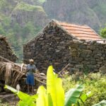
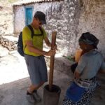
And the Longueira segment keeps it grounded. You’ll see houses carved into the mountains and spend time visiting a local family to hear about daily life in the region. That’s the kind of moment that makes the whole day more than exercise.
You can also read our reviews of more hiking tours in Praia

Price and timing: what your 6-hour day really includes

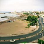
The price is $98.72 per person, and it’s booked about a month in advance on average. You’re also getting a free admission ticket, and the day is designed as one tight package: pick up in Praia, hike the core route, then return to your hotel.
In practical terms, the timing is simple:
- Start in Praia at 8:30 am
- Enjoy about 5 hours at the main hiking/visiting portion
- Finish with drop-off back in Praia (around 40 minutes)
You should plan on the whole experience feeling like a full morning. It’s long enough to be satisfying, but it also means you can still enjoy the rest of your holiday afterward.
Value-wise, the price makes sense if you care about guide-led safety and a structured route. This isn’t a “go at your own pace” walk on an easy path. With steep, narrow terrain, a local guide can save you energy and stress by pacing you and managing the rougher sections.
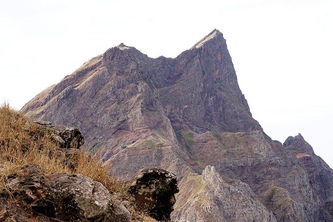
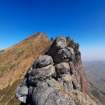
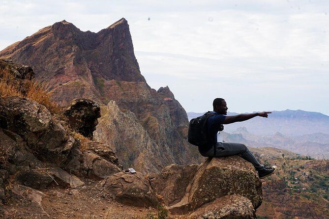
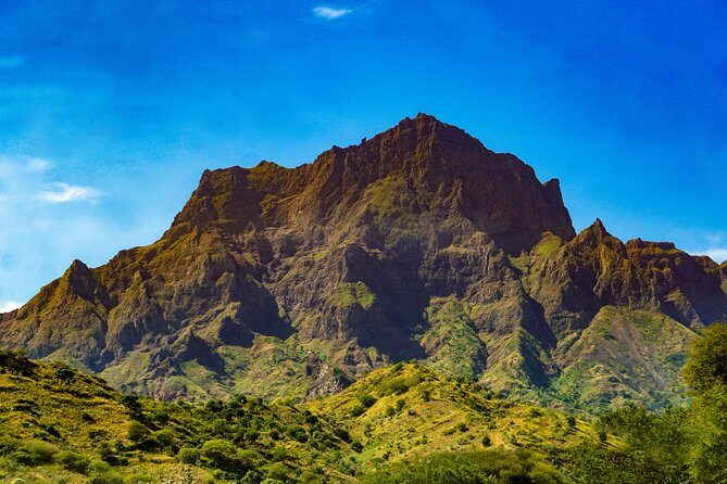
The climb to Pico D’Antónia (1,394m): difficult, but not random
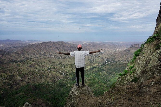
This hike earns its difficulty label. The route is about 9 km walking distance (give or take) with an elevation gain around 660 m and a much steeper overall elevation loss (about 1,280 m). Translation: you work uphill, then you spend a lot of time controlling your pace while descending.
The path quality is described as tilty and narrow. That doesn’t mean technical mountain climbing, but it does mean your attention needs to stay on your feet. There’s also mention of sections where you’ll do level 1 climbing. Think of it as short stretches where hands might help on uneven rock or awkward angles—not a full scramble, but definitely not flip-flop terrain.
If you’re fit, you’ll probably feel great about it by the middle. If you’re only “average active,” you’ll want to go slower than you think at the start. On hikes like this, early pace is everything. You want to save your legs for the descent, because that’s where your knees usually learn new feelings.
Endemic plants, birds, and seasonal crops on the way up
One of the smartest parts of this tour is that it doesn’t treat the ascent as one long chore. You walk through the natural park, and you’re not just staring at dirt the whole time. You learn about endemic plants and local birds, which gives the climb meaning and a reason to pause.
And the seasonal farming section is a neat reality check. Depending on the time of year, you might pass fields growing:
- corn
- mango
- coffee
- tomatoes
Even if you don’t know the crops, you’ll understand their role once you see how agriculture fits into the slopes. It’s a reminder that Cape Verde’s landscapes are shaped by adaptation and hard work, not just scenery.
The picnic lunch at the top: why that stop changes the whole day
The highlight list calls out a tasty picnic lunch on top, and the way the route is timed makes that stop feel well-placed rather than rushed. At Pico D’Antónia, you get the summit moment without turning it into a quick photo sprint.
This is also where you can reset mentally. After the effort of climbing, sitting for lunch gives you time to catch your breath and check how your body is doing. If the weather is cooperative, you’ll also have your best shot at those panoramic views.
So yes, it’s food. But it’s also strategy: a planned break that helps you enjoy the descent instead of hobbling through it.

Descending through farmland and Longueira’s carved mountain homes
What I love about the second half is the shift in scenery and rhythm. Once you come off the summit stretch, you descend through agricultural fields where crops change with the seasons. That part is active walking, but it’s also visually interesting. You’re moving through the working edges of the island.
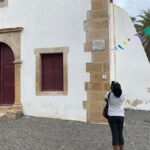
Then the tour turns toward Longueira’s human geography. You’ll walk among local houses carved into the Longueira mountains, and you’ll visit a local family to hear more about culture and daily life.
This is where the day becomes less “sights” and more “people.” A conversation like that can explain what you’re seeing: how families live with the terrain, how homes fit the environment, and why certain choices make sense out here. Even if your conversations are simple, you’ll come away with a better sense of what this region actually is beyond hiking.
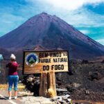
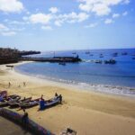
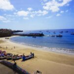
Views toward Fogo Island: enjoy them, don’t bet on them
The summit area can offer panoramic views, and on clear weather you may see Fogo Island with its volcano on the horizon. That’s a great bonus because it connects Santiago’s highest point to a bigger Cape Verde story.
But this tour is also honest about the reality: it depends on the day’s weather. If clouds or haze roll in, you can still enjoy the hike and the wildlife and the culture stops. Just don’t build your whole expectation around a perfect skyline.
If you’re sensitive to misty conditions or wind, bring the right layers. The higher you go, the faster conditions can change.
Guide, driver, and group size: safer hiking without feeling rushed
This experience runs with a maximum of 8 people, which is a real advantage. Smaller groups mean your guide can manage pacing, check that everyone is comfortable on narrow trails, and adjust the flow if the terrain demands it.
The tour uses an experienced local guide, and the reviews highlight how safe people felt and how steady the pace was. One review specifically mentioned the guide Cátia and driver Nilton, praising their passion for the country and their willingness to answer questions and offer recommendations.
That kind of guide energy matters because it turns a hard hike into a guided hike. You don’t want to spend the day guessing where to put your feet, where the route goes next, or how long a section will take. A good guide also notices when you need a short breather before you get stuck in “too tired to think” mode.
What to pack: the difference between a good day and a miserable one
This hike asks for proper footwear and gear. The guidance is clear: bring hiking shoes and hiking pants (especially recommended from August to October). Also bring a hat, sunscreen, and water.
You should strongly consider walking sticks too. The route information notes narrow, tilty paths and sections needing level 1 climbing. Sticks help with balance, take pressure off your knees during descent, and can make those uneven stretches feel controlled instead of frantic.
Here’s my practical packing checklist for this kind of Santiago hike:
- Comfortable hiking shoes with good grip
- Long hiking pants (more protective than shorts)
- Hat + sunscreen
- A filled water bottle (bring enough for a long morning)
- Walking sticks if you use them for stability
And dress for sun and shade changes. Higher ground can feel more exposed, and you’ll spend hours outdoors.
Who should book this Monte Tchota hike, and who should skip it
This is best for you if you:
- have strong physical fitness
- want a hike plus culture (not just a summit)
- enjoy learning about endemic plants, birds, and agriculture
- are comfortable on narrow, steep paths and can handle a difficult route
The tour also has a clear boundary: it’s for people over 16 years old, and it’s described as suitable for walkers with some fitness and no health problems.
I’d think twice if:
- you know you struggle on steep descents
- your footing is unreliable on uneven rock
- you need long rests or frequent pacing breaks
The hike length and difficulty are real. This isn’t a gentle nature stroll.
Should you book Monte Tchota to Pico D’Antónia?
If you want a morning workout with an actual story behind it, I’d book it. The combination of Pico D’Antónia, endemic plants and birds, a picnic at altitude, and the Longueira mountain homes gives you variety that a lot of single-peak hikes lack.
I’d also book it if you value safe guidance. The small group size and the strong emphasis on staying safe make it a smart pick for a difficult route.
Skip it only if you’re not ready for steep, narrow trails and a demanding elevation profile. On the right fitness day, this feels like the kind of Cape Verde experience you’ll remember for reasons beyond photos.
FAQ
What time does the Monte Tchota Natural Park hike start?
The start time is 8:30 am.
How long does the experience last?
It’s listed at about 6 hours total, with the main hiking/visiting portion lasting around 5 hours.
Where do you get picked up and dropped off?
You’re picked up in Praia (hotel pickup) and dropped off back at Praia (hotel drop-off).
Is admission included?
Yes. The admission ticket is listed as free.
How far and how hard is the hike?
The walking distance is about 9 km (±), and the route is marked difficult. The elevation gain is around 660 m and the maximum elevation is around 1,400 m.
Do I need hiking shoes, pants, or walking sticks?
The guidance is to bring hiking shoes and hiking pants (highly recommended from August to October), plus a hat, sunscreen, and water. Walking sticks are highly recommended.
Is there food included during the hike?
Yes. There’s a picnic lunch on top of the mountain.
Can I see Fogo Island during the hike?
You might, weather permitting. Panoramic views are also described as weather dependent.
What happens if the tour is canceled due to weather?
The tour requires good weather. If it’s canceled for poor weather, you’ll be offered a different date or a full refund.
How does cancellation work?
You can cancel for a full refund up to 24 hours before the experience starts. If you cancel less than 24 hours before, the amount paid isn’t refunded.